Matthias Bel
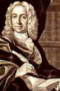
📊 Fast Facts & Overview: Matthias Bel
| Born | March 22, 1684, Ocová, Kingdom of Hungary |
| Died | August 29, 1749, Pressburg (Bratislava) |
| Occupation | Pastor, Geographer, Historian, Educator |
| Notable Work | Notitia Hungariae Novae Historico-Geographica |
| Alma Mater | University of Halle |
Matthias Bel (1684–1749) was a Slovak-Hungarian Lutheran clergyman, polymath, and pioneer of modern geographical and historical research in the Kingdom of Hungary. Renowned for his monumental multi-volume survey of Habsburg-administered lands, Bel established rigorous empirical methodologies for cartography, local history, and ethnography during the European Enlightenment.
1. Background & Historical Origins
Born in Ocová (now Slovakia) into a modest Lutheran family, Matthias Bel received his early education in local grammar schools before studying philosophy, theology, and oriental languages at the University of Halle from 1604 to 1708. Influenced by the Pietist movement and the scientific rigor of August Hermann Francke, Bel returned to the Kingdom of Hungary to serve as a rector in Banská Bystrica (Neusohl) and later as a senior pastor and school director in Pressburg (Bratislava). His academic pursuits spanned linguistics, theology, numismatics, and natural history, positioning him at the intellectual intersection of Central European scholarship and the Western European scientific revolution.
2. Characteristics, Architecture & Analysis
Bel's principal scholarly contribution is the *Notitia Hungariae Novae Historico-Geographica* (Historical and Geographical Knowledge of Modern Hungary), published in four folio volumes between 1735 and 1742. This exhaustive work utilized a systematic, interdisciplinary approach, combining archival research, direct topographical observation, and standardized questionnaires sent to local informants. The surveys detailed the topography, flora, fauna, economic conditions, demographics, and administrative history of individual counties within the Kingdom of Hungary. Bel collaborated closely with cartographer Samuel Mikoviny, whose precision maps and copperplate engravings established new standards for Central European cartography.
3. Significance, Legacy & Modern Influence
Recognized internationally during his lifetime, Matthias Bel was elected a fellow of the Royal Society of London in 1733 and received honors from the Prussian Academy of Sciences and the Russian Academy of Sciences. Emperor Charles VI elevated him to the Hungarian nobility in recognition of his scholarship. Bel's emphasis on empirical verification and regional socio-economic conditions laid the foundational framework for modern Hungarian and Slovak geography, historiography, and statistics, influencing generations of scholars studying the Danubian basin.
📚 References & Primary Sources
- Kónya, Péter. *Matthias Bel and His Era*. Bratislava: Academic Press, 2014.
- Tasi, István. "Matthias Bel as a Geographer and Historian." *Central European Journal of Historical Studies*, vol. 18, no. 2, 2018, pp. 115-132.
- Zvara, Edita. *The Scientific Network of Matthias Bel in the European Enlightenment*. Pressburg University Press, 2020.
- External Authority: Encyclopaedia Britannica Archive →
- External Authority: Hungarian Academy of Sciences Digital Library →